Land north of Alrewas Road,

King's Bromley, Staffordshire

Residential Development Opportunity

Outline planning application submitted for up to 69 dwellings.
30% affordable housing provision.

The Opportunity
8.82 acres (3.57 hectares) – up to 69 new homes

An opportunity to acquire land off Alrewas Road, Kings Bromley.

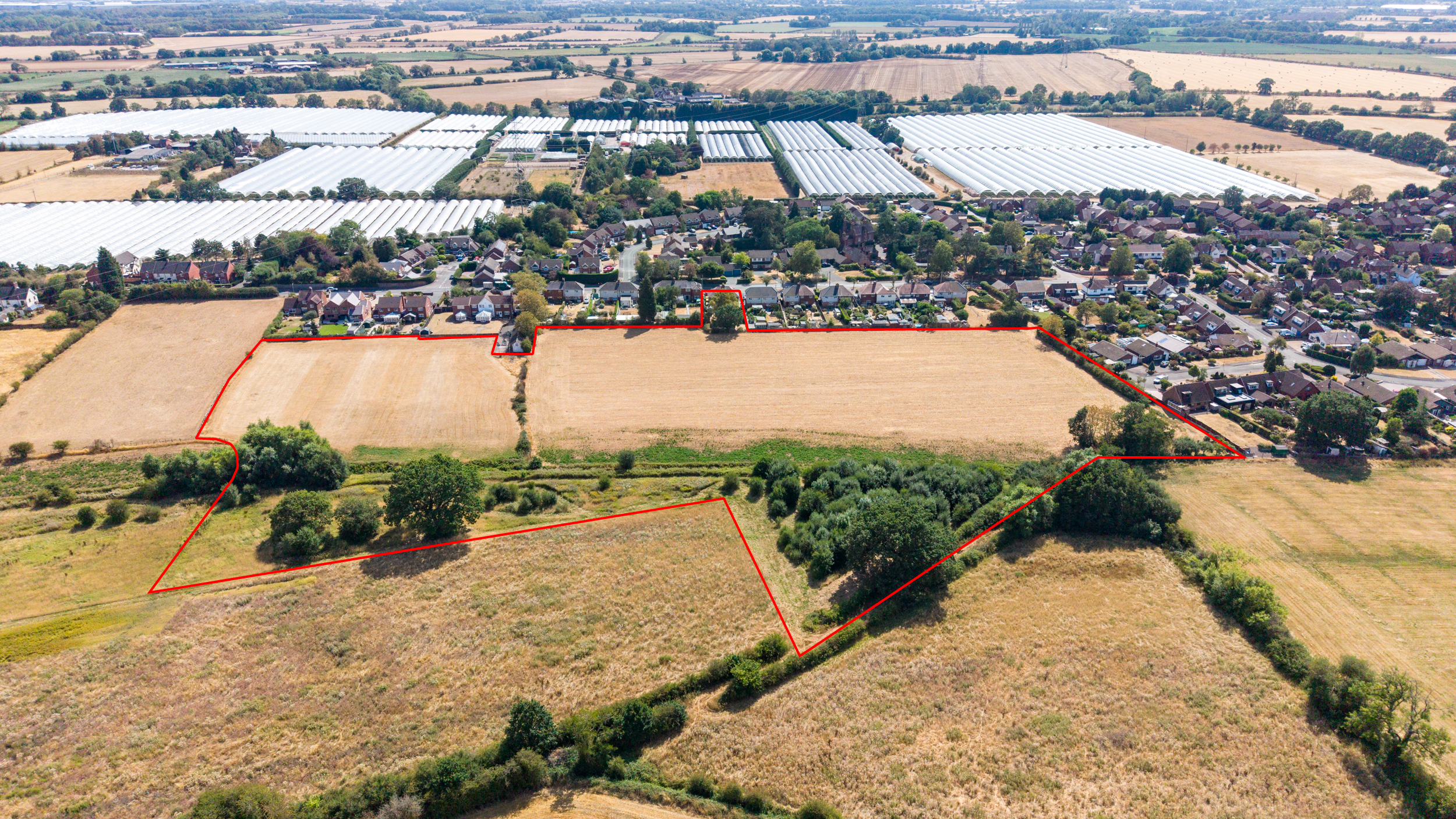
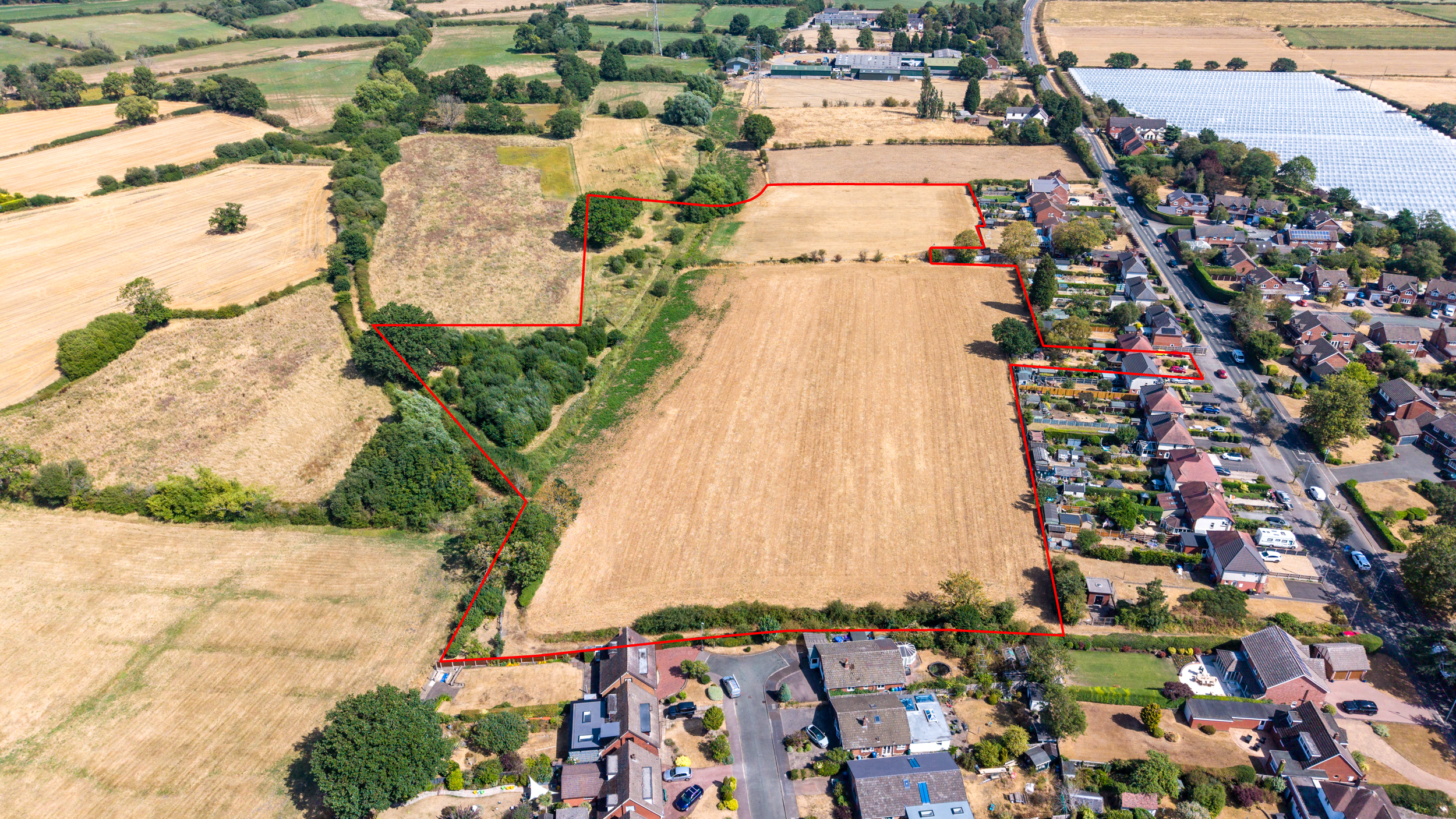
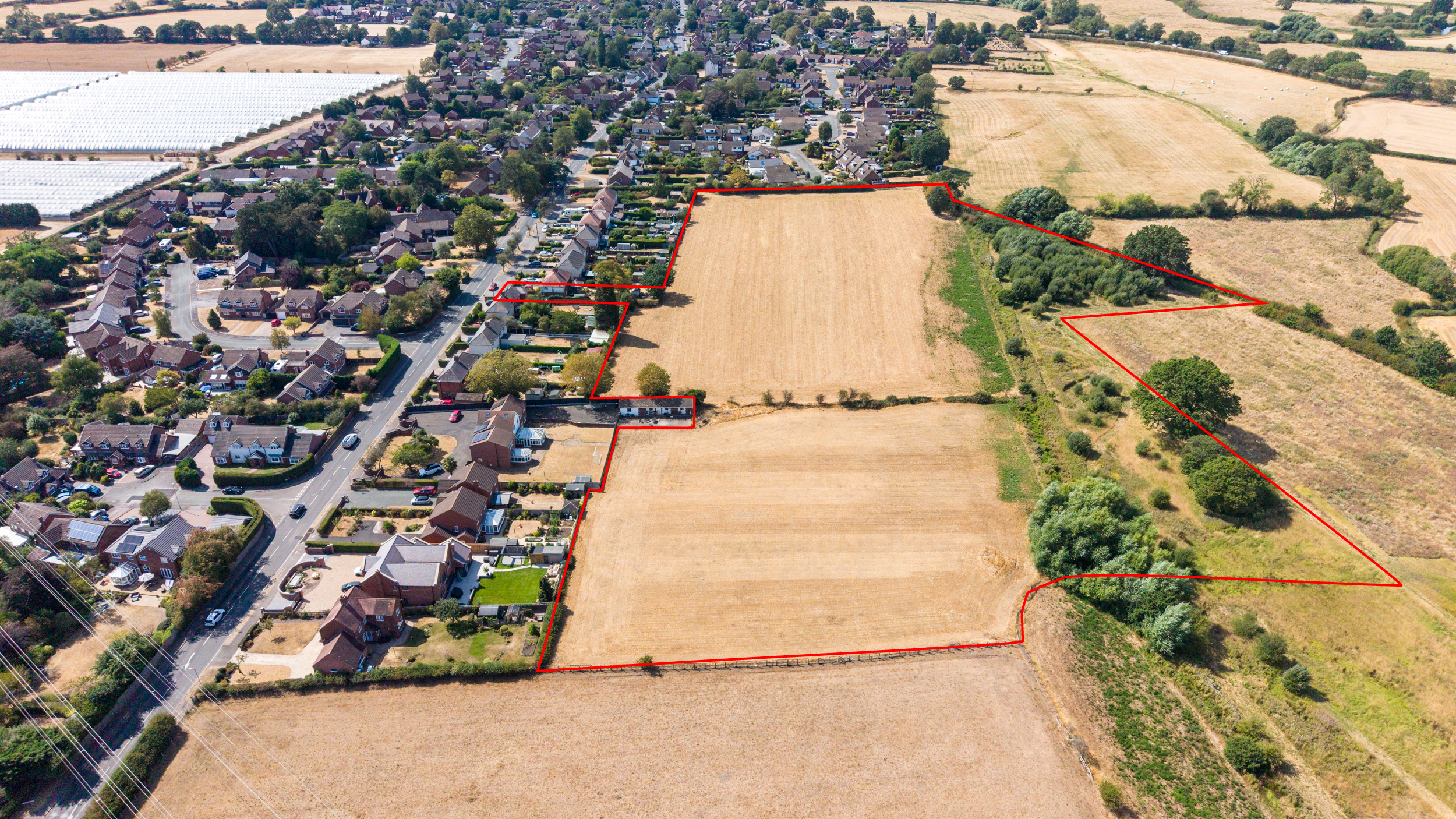
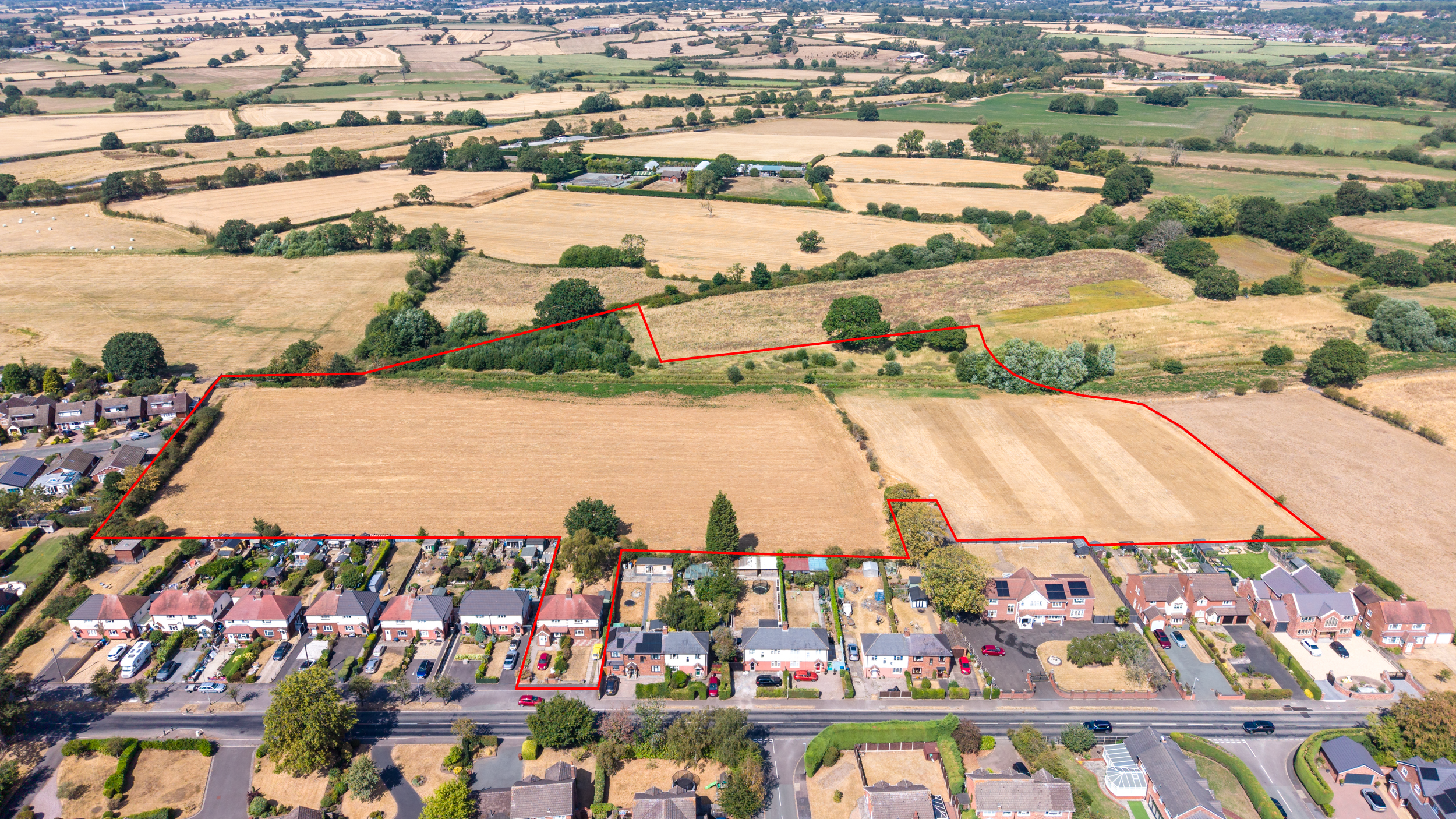
The site extends to approximately 8.82 acres (3.57 hectares) on the eastern edge of Kings Bromley, a village in Lichfield District, Staffordshire.

A live outline planning application (ref. 26/00431/OUTM) is before Lichfield District Council for up to 69 homes, with all matters reserved except access.

Key Highlights

A landscape-led residential opportunity, combining thoughtfully planned homes with green spaces and improved connections.

THE OPPORTUNITY

Up to 69 homes

An indicative mix of 1 to 4-bedroom properties within a thoughtfully planned community.

3.57

HECTARES

8.82 acres total site area

20

AFFORDABLE HOMES

Up to 20 homes integrated with market housing

ENVIRONMENTAL ENHANCEMENT

11.41%

Proposed biodiversity net gain in habitat units, alongside 134.30% in hedgerow units.

BEYOND THE NUMBERS

A considered approach to place. The wider proposals bring together community, landscape and connectivity.

01

Homes & community

Approximately 2.55 hectares of developable land, with a proposed mix of homes and up to 20 affordable dwellings.

02

Open space & recreation

A village green, pocket park, wildflower meadow, orchard, three proposed children's play areas and allotments.

03

Landscape & ecology

Retention of mature trees, woodland and most existing hedgerows, alongside sustainable drainage and habitat enhancements.

04

Access & connectivity

A new junction on Alrewas Road and pedestrian links to Myers Lane and The Croft, with access to Lichfield, Rugeley, Burton upon Trent and the A38.

05

Planning policy & housing supply

Outline planning application ref. 26/00431/OUTM. Kings Bromley is identified as an Other Rural Settlement in the Council's 2024 study. The Council's published housing land supply position was 3.65 years at 31 March 2025.

The Site

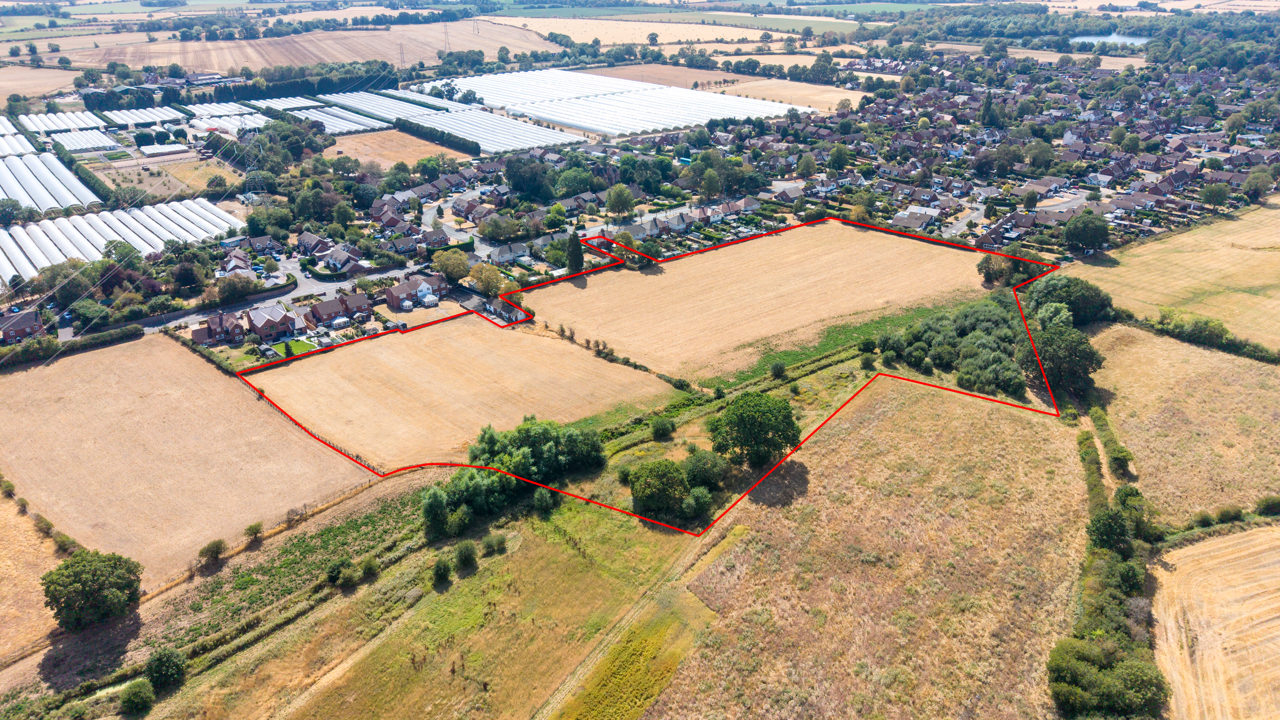
The site is agricultural land north of Alrewas Road. It also includes No. 91 and 93 Alrewas Road, which would be demolished to form the site access.

Homes on Alrewas Road and The Croft adjoin the southern and western boundaries, with open fields to the north and east. Myers Lane, a grassed track giving farm access to the fields beyond, runs along the western and northern boundaries.

The land falls gently towards a ditch that crosses the site from west to east. Most of the site is in Flood Zone 1; the northern part, beyond the ditch, lies in Flood Zone 2 on the edge of the River Trent floodplain.

Key site characteristics include:

  • Greenfield land adjoining the existing village edge
  • All proposed homes in Flood Zone 1, with only a play area and allotments in Flood Zone 2
  • Mature trees, broadleaved woodland and most hedgerows retained, with only three trees removed under the indicative layout
  • Kings Bromley Conservation Area around 200m to the west, with no intervisibility with the completed scheme
The Proposed Development

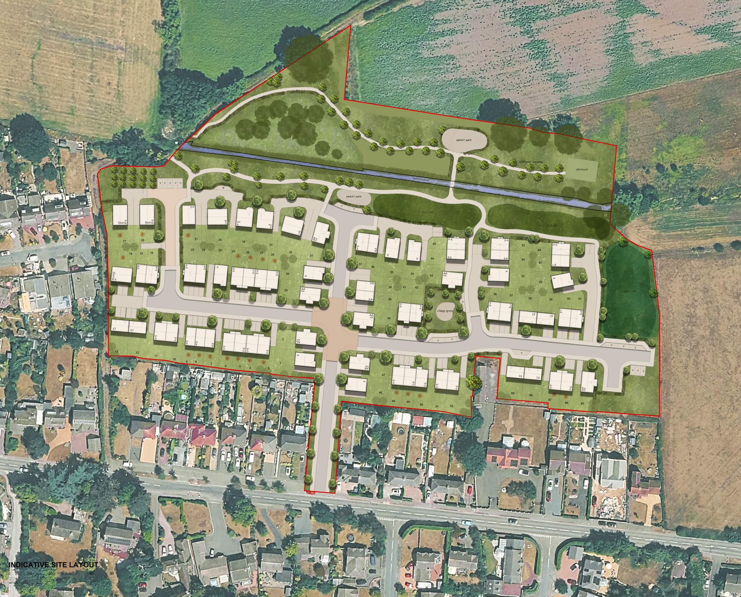
Proposals for up to 69 homes on around 6.30 acres (2.55 hectares) of developable land, at about 27 dwellings per hectare, set around central open space with a soft, planted edge to the countryside.

The scheme includes:

  • A mix of 1-bedroom bungalows and 2, 3 and 4-bedroom houses, around 90% of them two and three-bedroom
  • Up to 20 affordable homes, tenure-blind and integrated with the market housing
  • Vehicular access from a new junction on Alrewas Road
  • Public open space including a village green, a pocket park, a wildflower meadow and a new orchard, with three play areas and an allotment
  • Sustainable drainage with wet and dry attenuation basins, designed as a habitat and visual amenity
  • Pedestrian links to Myers Lane and The Croft, and a footbridge over the brook connecting the open spaces
  • A biodiversity net gain of 11.41% in habitat units and 134.30% in hedgerow units, delivered on site
ILLUSTRATIVE MASTERPLAN
Location & Connectivity

King's Bromley, Staffordshire

Kings Bromley sits on the A515 between Lichfield, Rugeley and Burton upon Trent. The River Trent and Manor Park Lake lie to the west of the village, with Kings Bromley Waterside and Marina around 2km to the south-west.

The Victoria Meadows bus stop, directly west of the proposed access, is served by the 12, 12A and 12B between Lichfield and Burton upon Trent, around once an hour from Monday to Saturday. Journeys take around 25 minutes to Lichfield and 30 minutes to Burton.

Lichfield, Burton upon Trent and Rugeley stations offer services towards Birmingham New Street, Derby and Nottingham, and the 12 terminates at Lichfield bus station, directly opposite the railway station.

Everyday facilities, including the Co-op and post office, the village hall, Richard Crosse C of E Primary School and the Royal Oak pub, are within a 5–10 minute walk of the site along the footways on Alrewas Road.

The village hall grounds include an equipped play area, the cricket club is under 15 minutes’ walk away and the sailing and angling lakes to the west around 20 minutes. School buses serve John Taylor High School in Barton-under-Needwood and Friary School in Lichfield.

Contact

For Further Information

A comprehensive Planning, Technical & Legal Information Pack will be available to interested parties.

Julie Doherty
Sales Director

T: +44 (0)1270 878888
E: jad@muller-property.co.uk

Muller Property Group Logo Black
DATA-ROOM

Register Your Interest

Register your details using the form below to receive access to the data room.

Important Notice

These particulars are intended only as a general guide and do not constitute, nor constitute any part of, an offer or contract. Neither the Vendor nor its agents give any warranty as to the accuracy or completeness of the information contained within these particulars. Prospective purchasers must satisfy themselves by inspection, enquiry and independent professional advice as to the correctness of all information provided. Any areas, measurements and distances are approximate. Plans and photographs are for identification and guidance purposes only and are not necessarily to scale. Prospective purchasers should satisfy themselves in respect of planning, highways, drainage, services, ground conditions, environmental matters, boundaries, rights, easements, covenants and all other matters affecting the property. All offers will be subject to contract.

© 2026 Muller Property Group